
Victoria Harbour Heritage Trail
STOP 15
The Blue Lake
Location: Intersection of Moonee Ponds Creek and the Birrarung/Yarra River
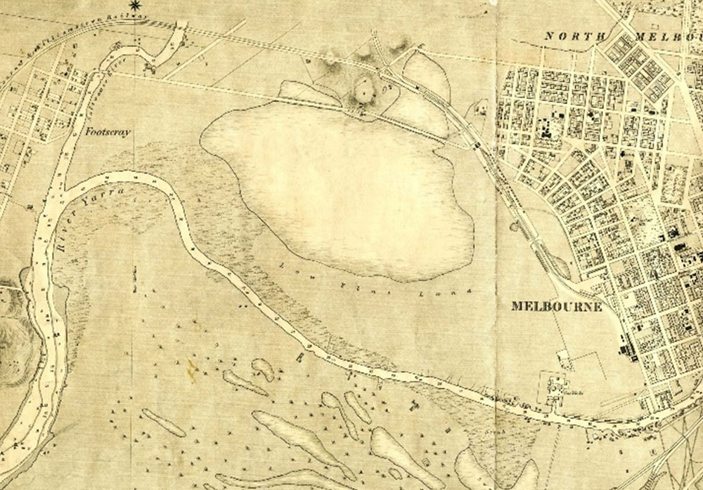
A major part of the low-lying intermittent swamps and lagoons collectively known as the West Melbourne wetlands (Batman Swamp) were described by early colonists as an intermittent ‘Blue Lake’ (West Melbourne Swamp / Batman Swamp).
With the drainage of the swamplands and the construction of the Coode Canal, spoil from the excavation of the canal created a vast 97-hectare new island, bounded to the east by the Moonee Ponds Canal, Maribyrnong River to the west, and the meandering Yarra River to the south. Initially, the chief use of Coode Island was as a quarantine station for stock, and buildings were constructed in the event of the need for a bubonic plague sanitorium. Coode Island ceased to exist as a true ‘island’ after the mid-twentieth century. Over the years the original course of the Moonee Ponds Canal was gradually filled-in and the former West Melbourne swampland was reclaimed.
In 1929 the construction of Appleton Dock (1956) on the south-east corner of Coode Island was begun. Swanson Dock (1968) was excavated out of the island near its south-west corner when containerised cargo services began in the 1960s. At this time, MacKenzie Road was constructed to the west of Swanson Dock, and bulk petro-chemical storage tanks were built along it.
The evolving changes in vessel sizes, propulsion systems and navigational manoeuvrability affected the river and port facilities. The transition from labour-intensive general cargo handling and storage methods to the ‘roll-on roll-off’ and container technologies have brought changes in both ship types and the design and operation of port cargo-handling facilities.
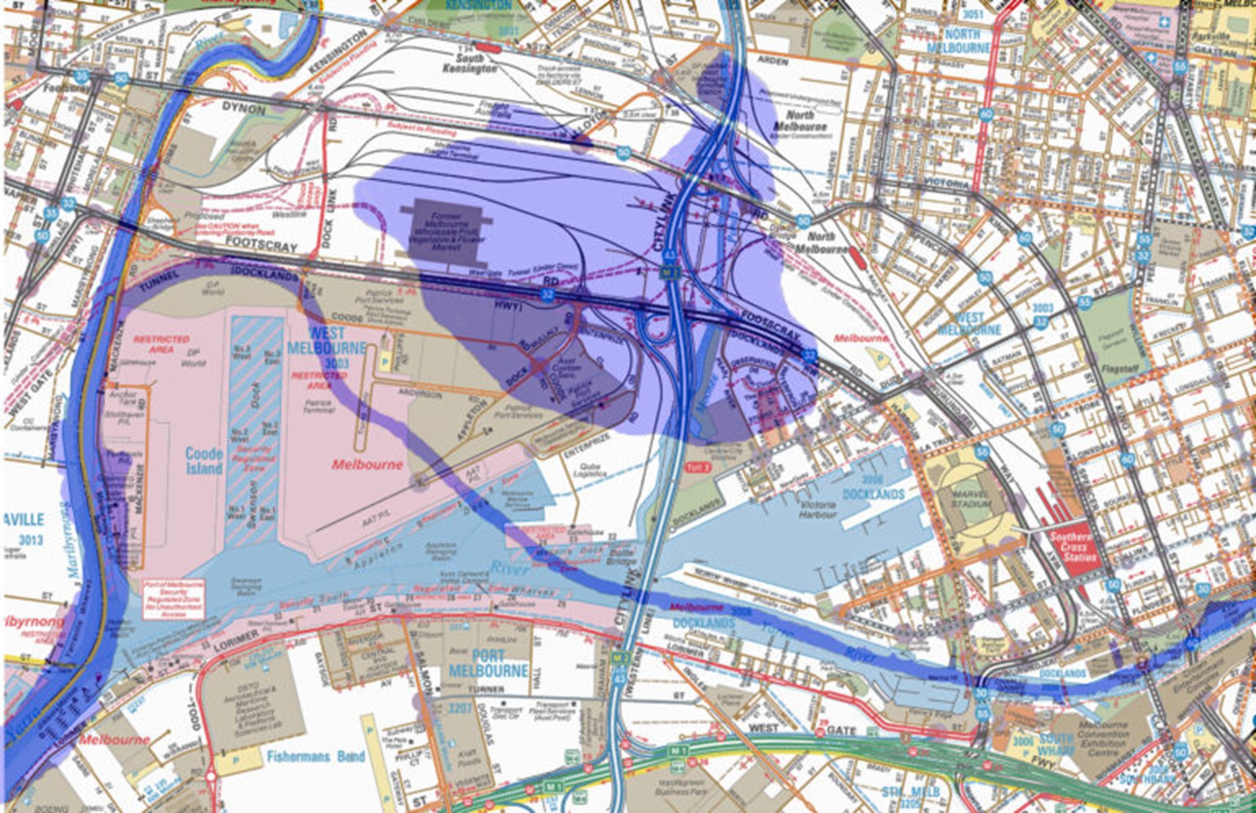
In the 1990s, one of Australia’s largest industrial and urban renewal projects commenced. This involved ‘re-purposing’ the area with the creation of Docklands Precinct and in its centre, Victoria Harbour, incorporating much of the area which was the ‘Blue Lake’. This area is now also occupied by the Port of Melbourne’s Swanson and Appleton Docks and associated container storage and rail yards, and Melbourne Freight Terminal.
The features of the land which sustained aboriginal people for millennia prior to European settlement in 1835 is changing. The wetland is now represented by the Dynon Road Tidal Canal, parallel to Dynon Road, and a small wildlife reserve, while, due to the size of the current container ships, the docks are gradually moving southwards, from Webb Dock at Fishermans Bend and Hobsons Bay.
The point at which you are standing provides the ‘best view in Melbourne’ as the river, the harbour and the docks can all be seen, with the Central Business District providing the backdrop. This is the end point of the Melbourne Maritime Heritage Trail around Victoria Harbour.
FURTHER READING
- https://portal.engineersaustralia.org.au/system/files/engineering-heritage-australia/nomination-title/HRP.Coode%20Canal%20%26%20Victoria%20Dock.Nomination.V13.May%202016.pdf
- https://www.victorianplaces.com.au/coode-island
IMAGE CREDITS
Image 1: Hobson’s Bay & River Yarra, Melbourne, Henry Cox, 1866, Royal Historical Society of Victoria
Image 2: The Swamp Vanishes, Royal Historical Society of Victoria exhibition, 2020, https://www.historyvictoria.org.au/the-swamp-vanishes/